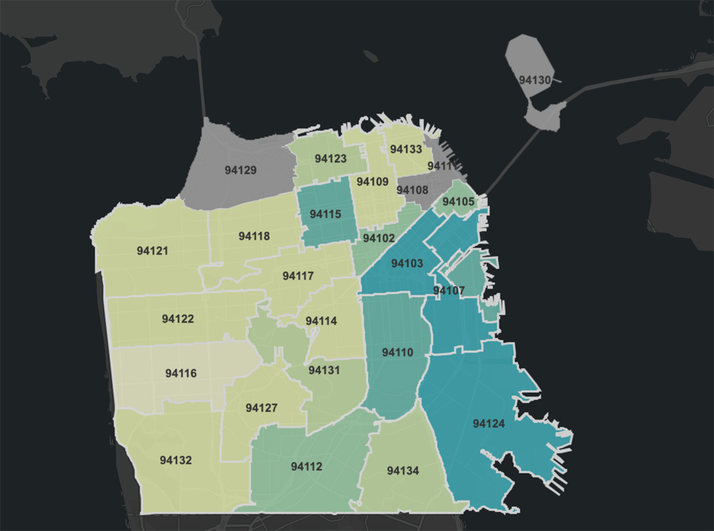
Map of Confirmed COVID-19 Cases Shows The Mission is Most Affected Neighborhood
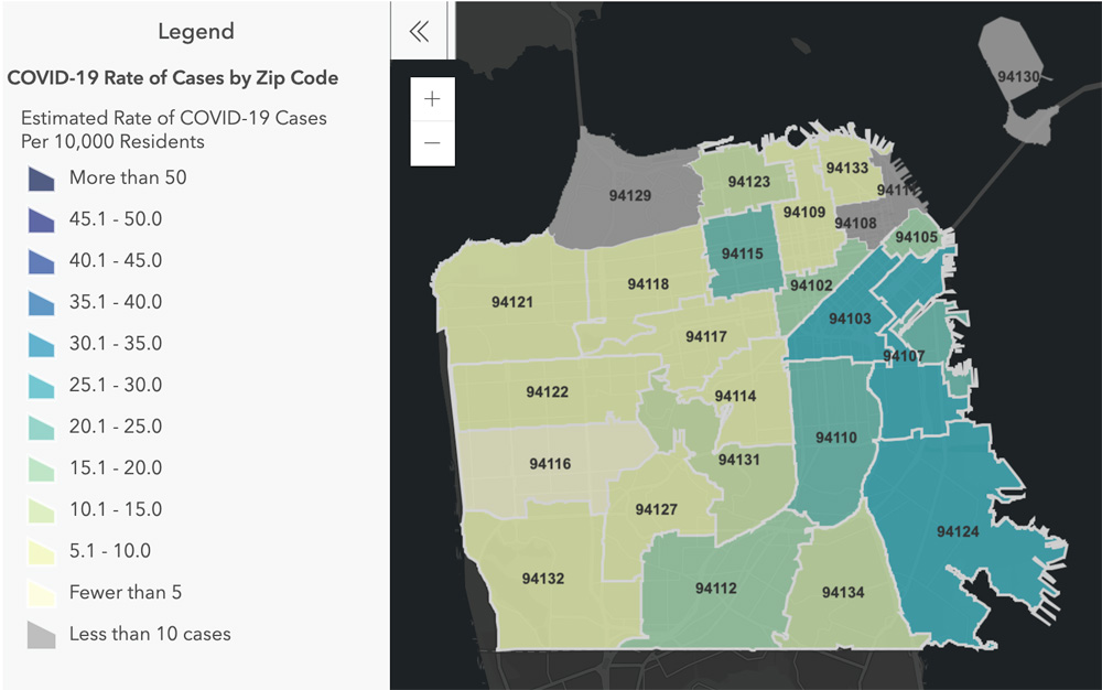
Today the mayor of SF announced an interactive map of known confirmed cases of coronavirus by zipcode.
What it reflects is the existing health disparities and inequality that existed within our city before COVID-19, which is why we continue to focus on protecting our most vulnerable residents. – Mayor London Breed
You can see by the chart that the highest cases per 10,000 residents appear in The Mission and SoMa neighborhoods. While the highest number of cases appear to be in The Mission and Outer Mission.
Most affected by zip code:
94110: 171 Cases
94112: 137 Cases
94124: 99 Cases
94107: 83 Cases
94103: 80 Cases
94115: 76 Cases
94134: 65 Cases
94109: 56 Cases
94102: 53 Cases
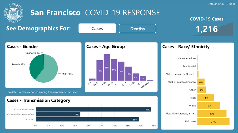
25% of the cases are Latino and Hispanic while they are only 15% of the population of San Francisco.
See the interactive data and map here: https://data.sfgov.org/stories/s/fjki-2fab *Data updated daily by 9:00am
We are asking you to continue not gathering in large groups, to stay at home, to use face covering, to use common sense, and continue to take care of yourselves and your family members so that we can get through this as safely as possible. – Mayor London Breed


May i ask for the Covid -19 status in 94110 zip code. Is is safe to open Dental Offices at this time?