Get Back to Nature! A Guide to 15 Photo-Worthy Hikes in the SF Bay Area
In a city like San Francisco where the weather is mostly moderate, it’s sometimes hard to tell when summer really begins. So, in case you missed it–this past week was the Summer Solstice, meaning we officially entered the season of gettin’ outdoors! And we’ve got you covered with a list of the 15 best nature outings that are all within an hour or less of the city by car or public transportation. (Read: more nature, less bank-breaking.)
It’s a small disservice to list only a few spots (because there are tons if you want to explore further out!), but here are our picks for the summer–including both popular and lesser-known hikes to get you outdoors.


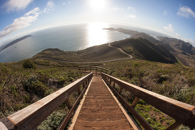
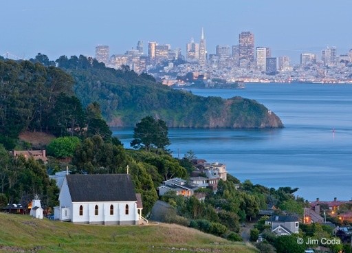
San Francisco from Angel Island (photo courtesy of CA.gov)
1. Angel Island, San Francisco/Tiburon (Ferry Only), CA
Known as the “Ellis Island of the West,” Angel Island is a California State Park with over 100 years of military history dating back to the U.S. Civil War. The island is accessible by a ferry ride and offers 360-degree views of the Bay. Two trails take you to various points of the island, but the Northridge Trail will give you that ideal photo opportunity at the summit of Mt. Livermore. The breezy ferry trip from San Francisco is worth the extra trip alone—just make sure your timing is right for the last ferry out.
Easy: 5 miles, up to 788ft elevation
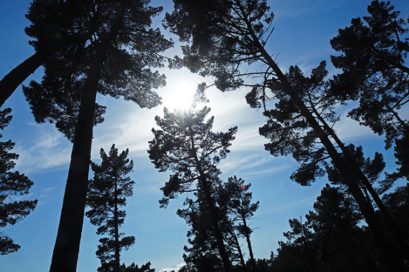
 Snow on Mt. Diablo (photo by Marc Crumpler)
2. Black Diamond Mines Regional Preserve, 5175 Somersville Rd, Antioch, CA
Home to the largest coal mining operation in California, dating back to the 1960s, the Black Diamond Mines Regional Preserve traverses Markley Canyon, which runs up the middle of the preserve. Notable features are the Rose Hill Cemetery, which appears frequently on “haunted places” lists, and the Hazel-Atlas Mine, a mining hub for silica sand that was once shipped to Oakland to produce glass. These trails offer views of Mt. Diablo, the San Joaquin River Delta, and the Sierra Nevada on a clear day. Try the Lougher Loop Trail for a more strenuous hike.
Moderate: 3.5 mile loop, up to 700ft elevation change
 Bull Valley Trail at Port Costa (photo by Davor Desancic)
3. Carquinez Strait Regional Shoreline Park, Port Costa, CA
Admittedly a pretty tame section to hike, the main draw here is the town of Port Costa, sandwiched between both ends of the West trail section (the East section continues in Martinez). Access the Bull Valley Trail on Winslow Street near Eckley Pier and stop in for one of 250 beers poured at the famed Warehouse Cafe along the way. Once a bustling pier, construction of the Carquinez Bridge diverted traffic out of Port Costa and the neighboring town of Crockett to the North Bay, giving it that “forgotten” feel–and plenty of cows to watch out for on the way back.
Easy: 1.5 miles, up to 210ft elevation
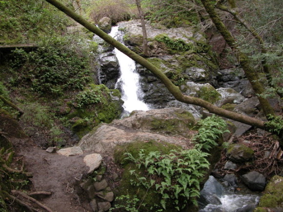 The waterfall at Cascade Falls (courtesy of bahiker.com)
4. Cascade Canyon Open Space Preserve, Fairfax, CA
Parking is limited to tiny residential streets for this dynamic hike through the Corte Madera Creek watershed. The Cascade Falls Trail takes you alongside a creek and to a 20-foot waterfall that surely makes this trip worthwhile. The surrounding trails have their own special appeal, leading you up narrow hillsides and excavating trees and brush to spontaneously find yourself in wide open spaces again.
Easy-Moderate: 1.2, up to 500ft elevation
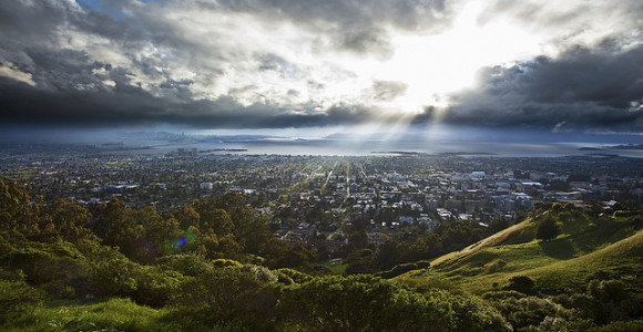 Berkeley Hills from Panoramic Hill (photo by Fred Rowe)
5. Claremont Canyon Regional Preserve, Claremont Avenue, Berkeley, CA
This steady incline doesn’t look like much at a glance, but there could very well be a workout involved for the unseasoned hiker. Climb the Stonewall-Panoramic Trail and continue through the Strawberry Canyon Loop for breathtaking views of Oakland and San Francisco set against the sprawling Bay. Situated at the base of nearby Tilden Regional Park is Grizzly Peak where you can go for a ride on a 1950s Redwood Valley Railway miniature locomotive.
Difficult: approx. 6.7 miles, up to 1,800ft elevation
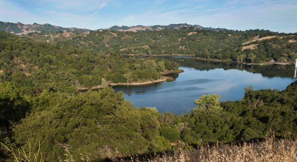 Lafayette Reservoir from the Rim Trail (photo courtesy of EBMUD)
6. Lafayette Reservoir Recreation Area, 3849 Mt. Diablo Blvd, Lafayette, CA
While it might not be the most isolated escape from city life, as you’re sure to run into a dozen or more people along the trail, the Lafayette Reservoir is still a great place to enjoy the day and even break a sweat with its multitude of rolling hills. The Rim Trail here wraps around the perimeter of the park, while the Shore Trail circles the Lafayette Reservoir. Spend the day cruising across the water in a rowboat, pedal boat or kayak rental.
Easy: approx. 4.7 miles, up to 157ft elevation
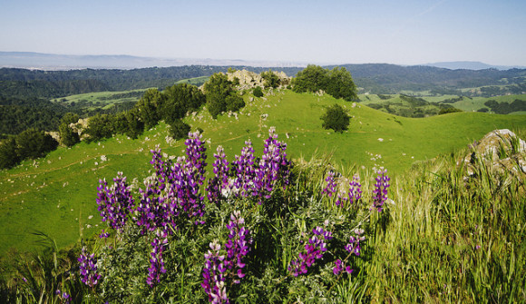 Lupines on the trail at Las Trampas (photo by Davor Desancic)
7. La Trampas Regional Wilderness, 18012 Bollinger Canyon Rd, San Ramon, CA
Over 5,000 acres of land could take you through an overgrown oak tree tunnel, past a waterfall, and across an expanse of open fields where you might catch a herd of cows along the way. The Bollinger Creek Loop Trail takes you around the stream and nearby Las Trampas Stables where horseback riding lessons are offered. Follow one the Rocky Ridge View Trail to view impressive rock formations created by the Las Trampas and Bollinger fault lines.
Moderate: approx. 3.5 miles, up to 1,800ft elevation
 Waves at Tennessee Valley Beach (photo courtesy of NPS/Will Elder)
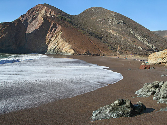
8. Marin Headlands, 948 Fort Barry, Sausalito, CA
The Marin Headlands Coastal Trail is one of the more popular trails perfect for beach goers looking to fit in some exercise. The hike start at Rodeo Beach near the Visitor Center, taking you past landmark Nike missile bunkers alongside majestic views of the Golden Gate Bridge, all the way to Muir Beach just south of Muir Woods. The trail follows the coastline and wanders through both the Tennessee Valley Beach and secluded Pirate Cove. Bring a bathing suit for a nice respite from the heat but watch out for sneaky waves in high tide.
Moderate-Difficult: approx. 11.8 miles, up to 3,500ft elevation
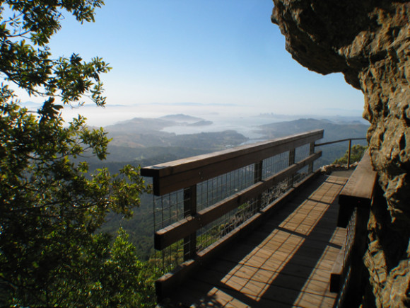 Lookout from Mt. Tamalpais State Park (courtesy of CA.gov)
9. Mount Tamalpais State Park, 3801 Panoramic Hwy, Mill Valley, CA
Similar to Oakland’s Redwood Regional, this adventure is a lot less touristy, and sports fewer trees than nearby Muir Woods. However, what it might lack in scenery, it makes up for in character with the Steep Ravine Trail, which winds through a series of bridges, ladders and curling stone steps taking you over 1,000 feet up. Make Stinson Beach your halfway point stop for beach-y souvenir finds and raw oysters at the historic Sand Dollar Restaurant.
Moderate: approx. 7.3 miles, up to 1,600ft elevation
 Old Hilary’s Church on the hill (photo courtesy of Belvedere-Tiburon Landmarks Society)
10. Old St. Hilary’s Open Space Preserve, 2000 Vistazo St W, Tiburon, CA
Along the crest of the Belvedere-Tiburon coast lies a small preserve with stunning million-dollar views of the Bay, ideal for picnics or kite-flying. Here, you may bear witness to the rare Tiburon jewel flower, a member of the mustard family that can appear black in color. Feel like you’re in a movie standing next to iconic Old St. Hilary’s Church, one of just a few remaining Carpenter Gothic-style structures. Combine this with a voyage through the bordering Tiburon Uplands Nature Preserve for a semi-strenuous one-mile loop through 24-acres of mature woodlands.
Easy: approx. 1.5 miles, up to 110ft elevation
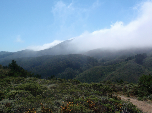 Fog moving over Pedro Point Headlands (photo by Toni Corelli)
11. Pedro Point Headlands, Pacific Coast Highway, Pacifica, CA
One of the lesser traveled areas and only marginally difficult to locate, is the Pedro Point Headlands look out to the southernmost tip of Pacifica and Half Moon Bay. Next to Devil’s Slide Coastal Trail, a converted trail sectioned from Highway 1, the Arroyo Trail gives hikers equally colossal views with a fairly short and easy path to the summit. Trails can be rugged and more remote, as the land is slowly being revitalized from past off-highway vehicle use.
Moderate: approx. 2.5 miles, up to 700ft elevation
 Redwoods from the East Ridge Trail (photo by Andrew Aldrich)
12. Redwood Regional Park, 7867 Redwood Road, Oakland, CA
You don’t have to go to Muir Woods to see towering trees. Just a short ride from downtown Oakland, Regional Redwood is a decidedly less crowded destination that houses the largest remaining second and third-growth forests in the East Bay with 150-foot Sequoias. This is where a map comes in handy, as the West Ridge Trail takes you through only a section of the nearly 40 miles of trails that traverse land that once supplied wood to all of San Francisco during its mid-1800s logging heyday. Plenty of picnic tables and flat trails make this a great spot for packing a lunch on your bike.
Moderate: approx. 5.4 miles, up to 1,250ft elevation
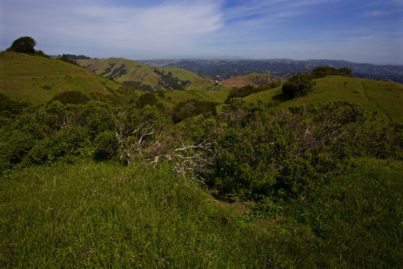 View from Sibley Volcanic Regional Preserve (photo by Kevin Fox)
13. Sibley Volcanic Regional Preserve, Skyline Blvd, Oakland, CA
The Round Top Loop Trail cuts through the preserve taking you through Round Top, a nearly 1,800-foot peak made of lava and volcanic debris that’s slowly collected over the past 10 million years from a volcano, as well as a couple random man-made labyrinths. You can also follow trails East to the 241-acre Huckleberry Botanic Regional Preserve, notable for its ecological prowess in housing a number of rare plant species found nowhere else in the East Bay.
Easy: approx. 2.6 mile loop, up to 1,600ft elevation
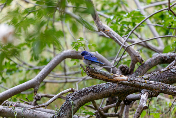 Bird sighting at Sunol Regional (photo by hamete via Flickr)
14. Sunol Regional Wilderness, 1895 Geary Rd, Sunol, CA
Sharing a border with Mission Peak Regional Preserve and Ohlone Regional Wilderness, Sunol Regional Wilderness is a slightly less traveled area with more than 6,000 acres of varied terrain bending around the Little Yosemite scenic gorge. The Canyon View Trail can be accessed at Calaveras Road, right near the mouth of Indian Joe Creek. Once you’ve begun your hike, there are a multitude of trails accessible through neighboring preserves, making it a perfect camping spot for longer backpacking trips.
Difficult: approx. 10.2 miles, up to 2,200ft elevation
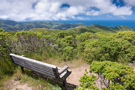 Bench at top of Sweeney Ridge (courtesy of NPS/Doug Atmore)
15. Sweeney Ridge, 170 Santa Maria Avenue, Pacifica, CA
The trail to Sweeney Ridge can elevate you over 1,000 feet up through the fog, traveling the northernmost part of the Santa Cruz range with unmatched views of Montara Mountain. For history buffs, this landmark spot is where European explorer Gaspar de Portola first discovered the San Francisco Bay. For a longer 10.8 mile hike, you can also follow the Mori Ridge Trail to Sweeney Ridge from Mori Point and grab sight the grandiose coastal views of Pacifica and the city of San Bruno to the East.
Moderate: approx. 7-mile loop, up to 1,400ft elevation


Recruiting partners for hiking!
Yep yesterday fool #latetothegame
Toya did you save this??
Bonnie Colvin angel island!
Therese Y need to get the mind healthy…think this will help!!
I’m so in!!!
Rachel! Look how cool these are!
Therese Y we should check some of these out!!!
Let’s plan our first bike when u come over on Monday
Jessica Castine lets get on it
Kat Kennedy let’s choose next weekend’s hike!
Excellent list. Thanks
Mike Chan Tgio Garcia let’s check these out!
Estoy tan celoso.
I’m so down for it.
Lu Lu Lu let’s go
My favorite is not listed, so maybe it will stay uncrowded!
Toya, Noelle, Jean-Marie let’s check these hikes out!!!!